GIS & Remote Sensing for Real Estate Mapping & Analysis
Turning Spatial Data into Strategic Decisions.
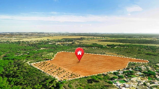
Lumel Consulting provides advanced GIS and remote sensing solutions to support informed decision-making in real estate, infrastructure, and land development projects. We transform complex spatial data into clear, actionable insights that help clients understand patterns, trends, and opportunities on the ground.
Our GIS services integrate technology with local knowledge to support smarter planning, risk management, and investment strategies.
What we do
GIS Database Development, Management & Maintenance
We design and maintain GIS databases for property, land, and asset mapping—ensuring accurate, up-to-date, and accessible spatial records.
Land Use & Zoning Analysis
We analyze land use patterns, zoning regulations, and development controls to identify legal restrictions, development potential, and optimal land utilization strategies.
Market Heat Maps
We develop spatial market intelligence tools that identify growth corridors, demand clusters, and emerging investment hotspots.
Custom GIS Solutions & Interactive Dashboards
We build custom mapping tools and dashboards for real-time project monitoring, asset tracking, and visual decision support.
Land Use Mapping for Investment & Planning
We produce thematic maps that support urban planning, infrastructure development, environmental assessments, and investment analysis.
Talk to Us
Whether you are planning a new development, managing land assets, or assessing investment potential, our GIS solutions give you clarity and confidence.